Rocky Mountain Regional Snowpack Chemistry Monitoring Study
Project Navigation
Questions?
Contact: Graham Sexstone
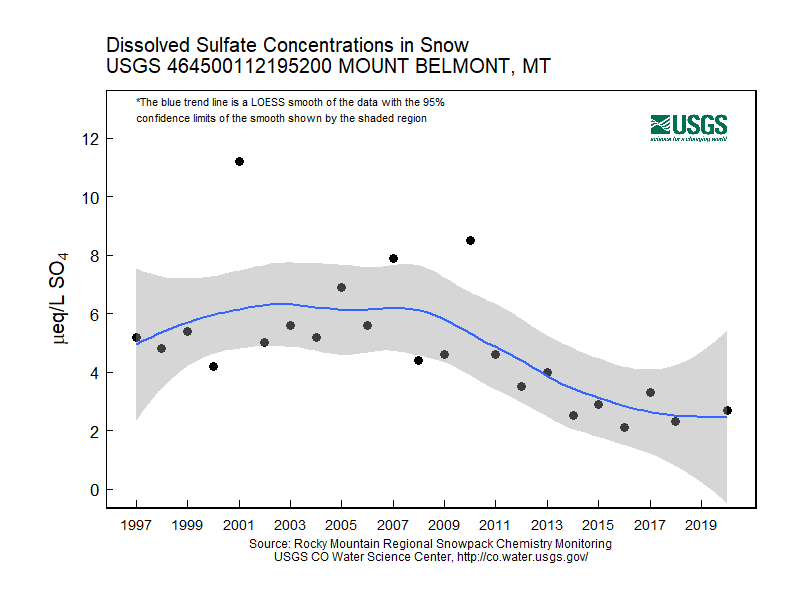
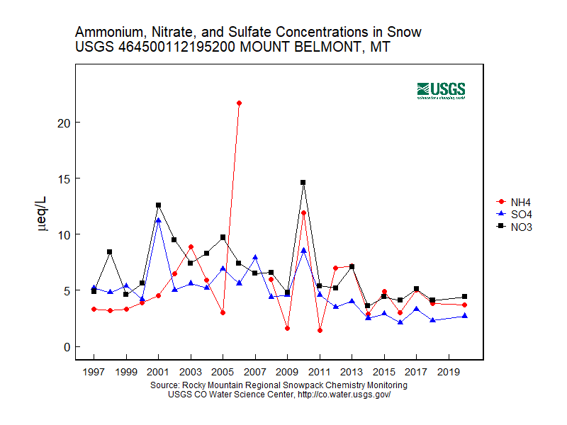
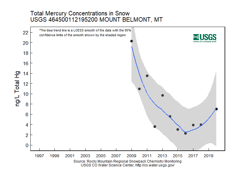
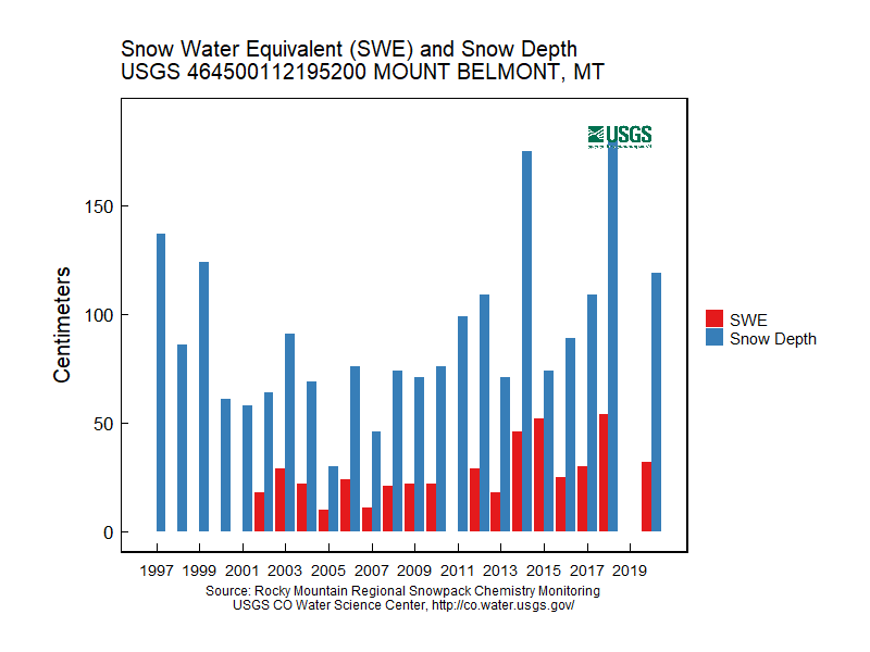
Mount Belmont, Mont.
- Station ID: 464500112195200
- Latitude: 46.74992 dd
- Longitude: -112.33111 dd
- Elevation: 2134 m
- 23 years of data
1997 - 2020 ( no data, 2019 )
Graphs of Chemistry Concentrations
Graph of Snow Depth
Data
- Table of data (download csv)