Rocky Mountain Regional Snowpack Chemistry Monitoring Study
Project Navigation
Questions?
Contact: Graham Sexstone
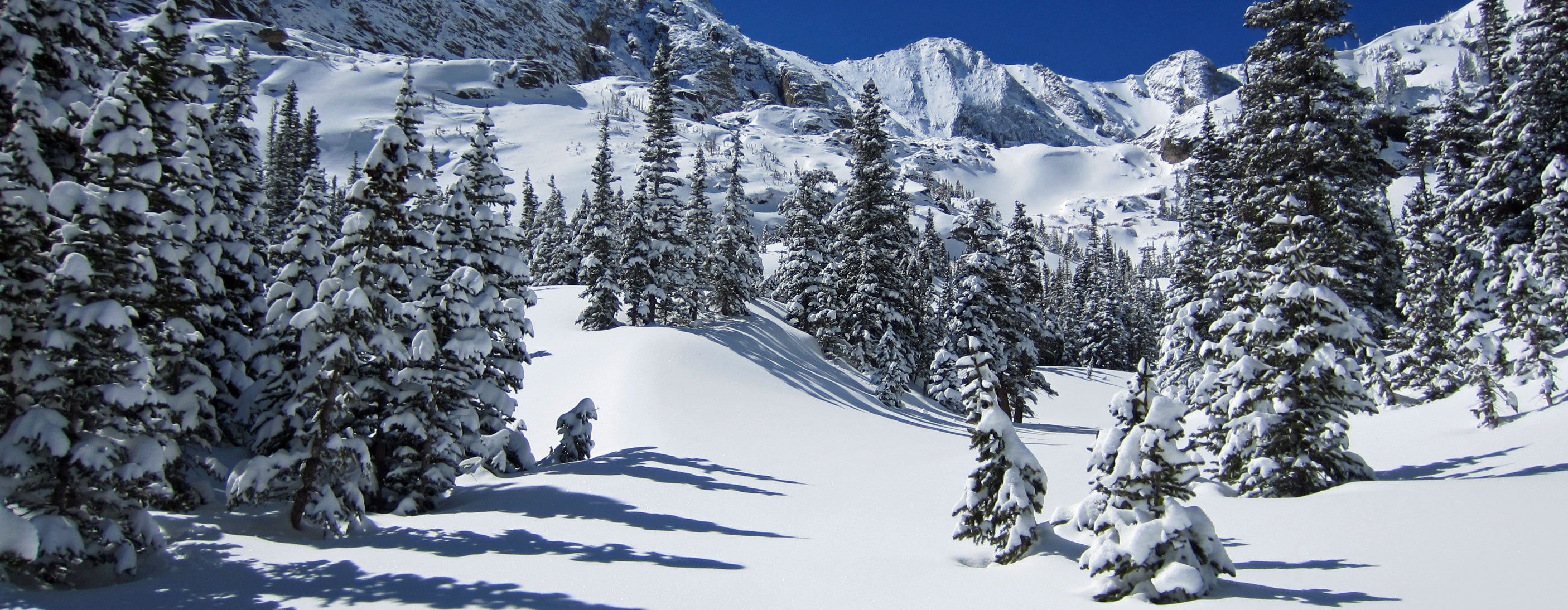
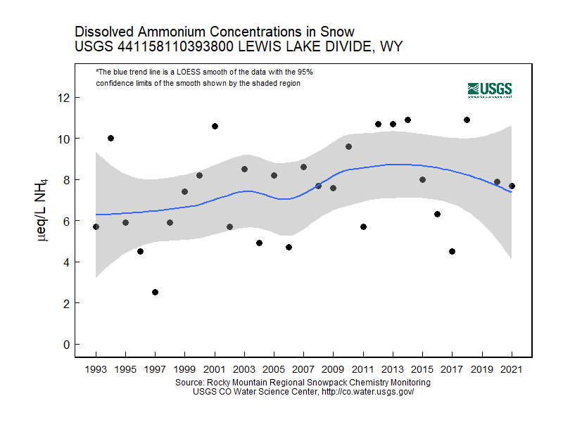
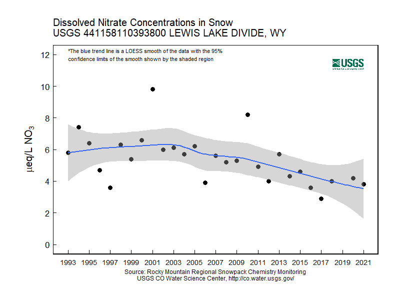
Lewis Lake Divide, Wyo.
- Station ID: 441158110393800
- Latitude: 44.19934 dd
- Longitude: -110.66045 dd
- Elevation: 2363 m
- 27 years of data
1993 - 2020 ( no data, 2019 )
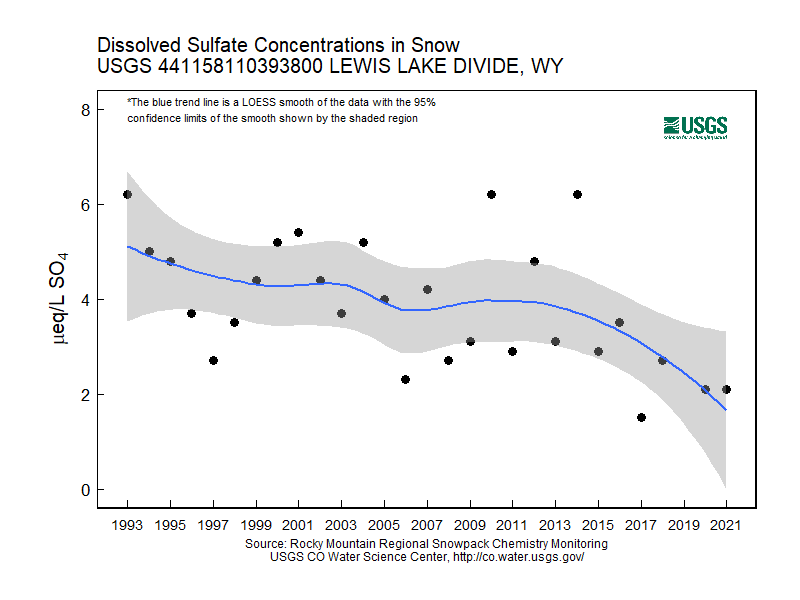
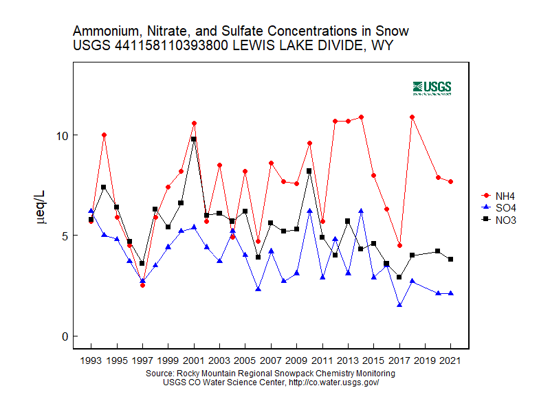
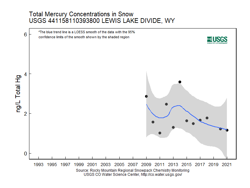
Graphs of Chemistry Concentrations
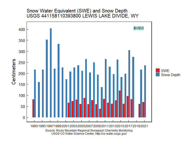
Graph of Snow Depth
Data
- Table of data (download csv)
Photographs
 Forest clearing at snowpack-sampling site near Lewis Lake Divide, Wyo. |
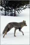
 Coyote on the road to the sampling site. |