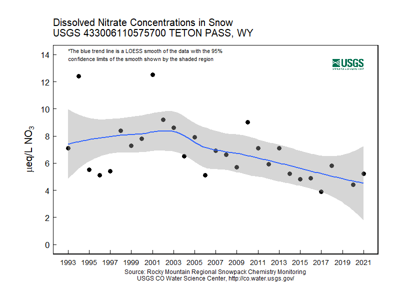
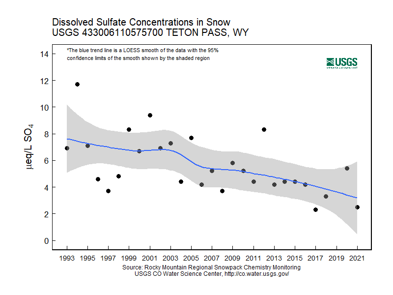
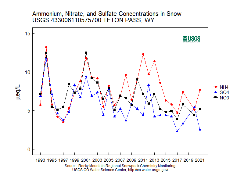
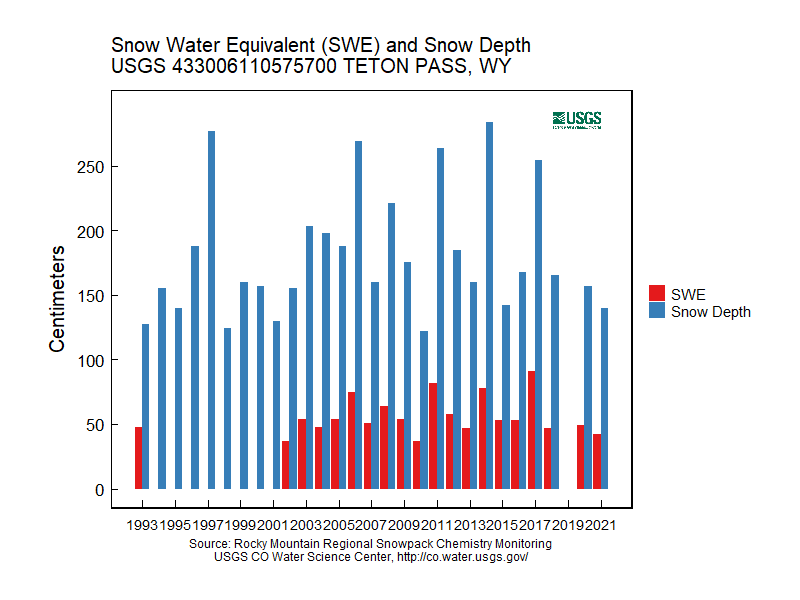
Rocky Mountain Regional Snowpack Chemistry Monitoring Study
Project Navigation
Questions?
Contact: Graham Sexstone
Teton Pass, Wyo.
- Station ID: 433006110575700
- Latitude: 43.50175 dd
- Longitude: -110.96583 dd
- Elevation: 2480 m
- 27 years of data
1993 - 2020 ( no data, 2019 )
Graphs of Chemistry Concentrations
Graph of Snow Depth
Data
- Table of data (download csv)
Photographs
 Workers prepare to haul snow samples away from site at Teton Pass, Wyo. |
 Weather station near snowpack-sampling site near Teton Pass, Wyo. |