Rocky Mountain Regional Snowpack Chemistry Monitoring Study
Project Navigation
Questions?
Contact: Graham Sexstone
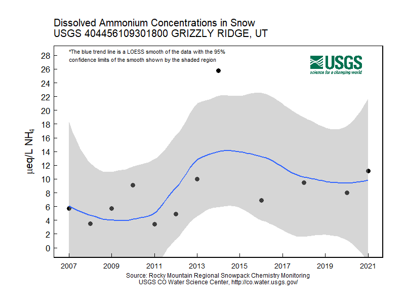
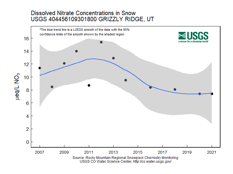
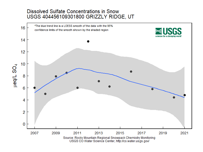
Grizzly Ridge, Utah
- Station ID: 404456109301800
- Latitude: 40.74886 dd
- Longitude: -109.50513 dd
- Elevation: 2913.888 m
- 11 years of data
2007 - 2020 ( no data, 2015, 2017, 2019 )
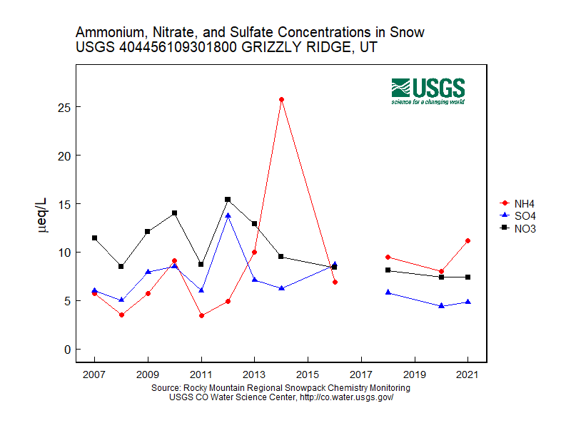
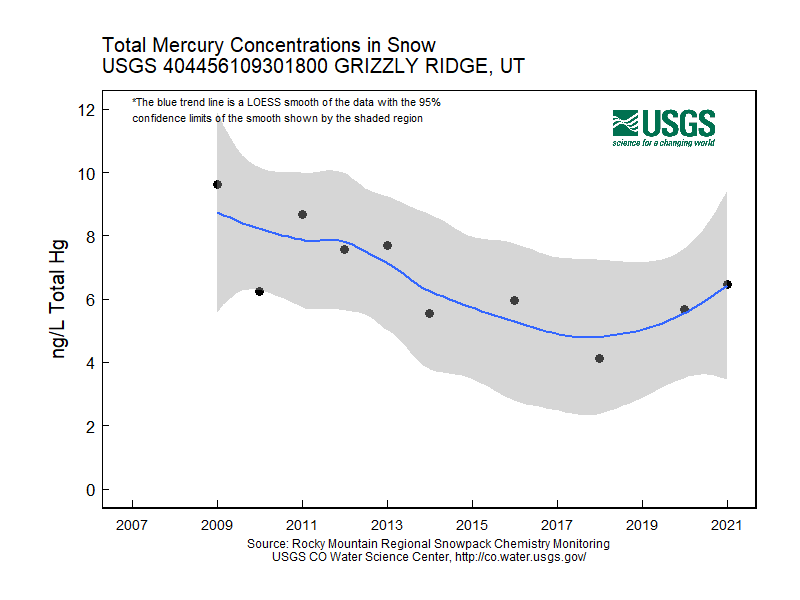
Graphs of Chemistry Concentrations
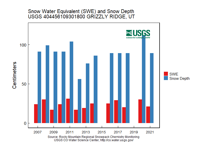
Graph of Snow Depth
Data
- Table of data (download csv)