Rocky Mountain Regional Snowpack Chemistry Monitoring Study
Project Navigation
Questions?
Contact: Graham Sexstone
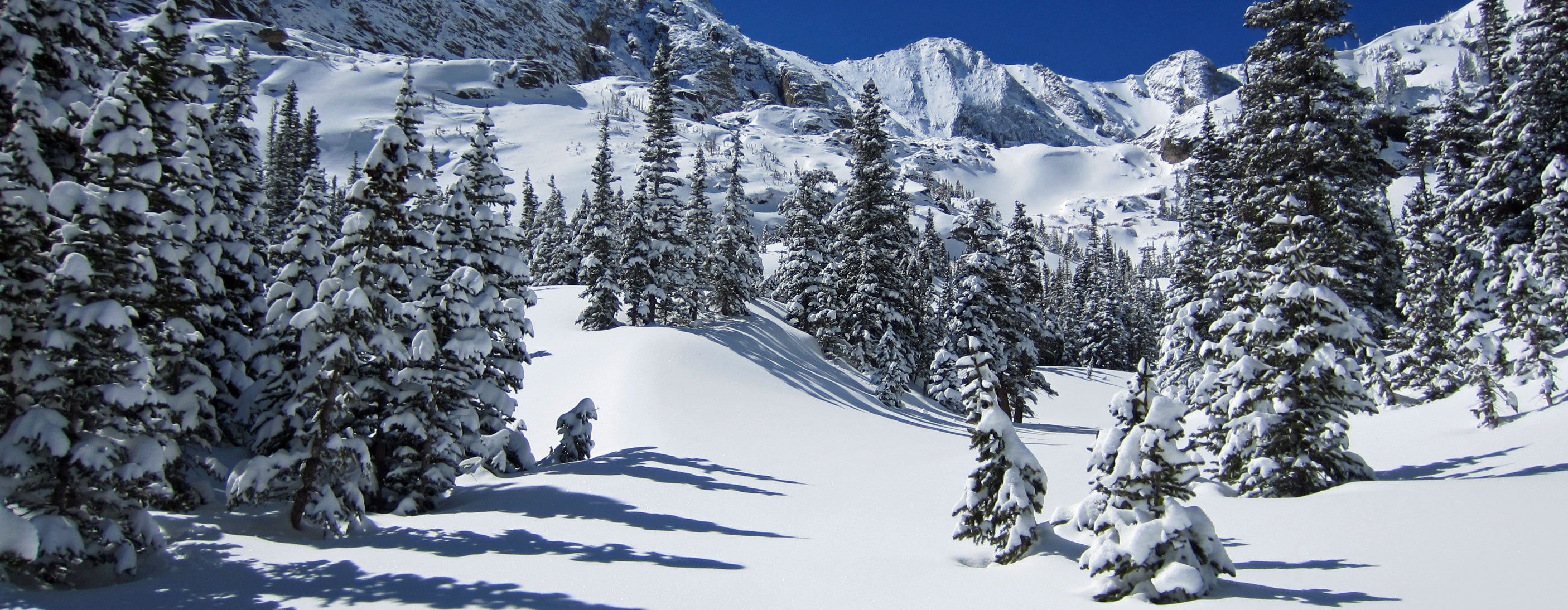
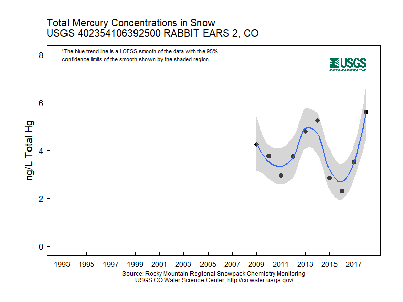
Rabbit Ears 2, Colo.
- Station ID: 402354106392500
- Latitude: 40.39890 dd
- Longitude: -106.65657 dd
- Elevation: 2986 m
- 25 years of data
1993 - 2020 ( no data, 2004, 2019, 2020 )
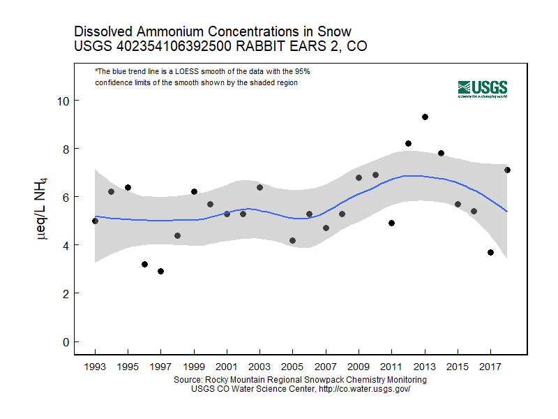
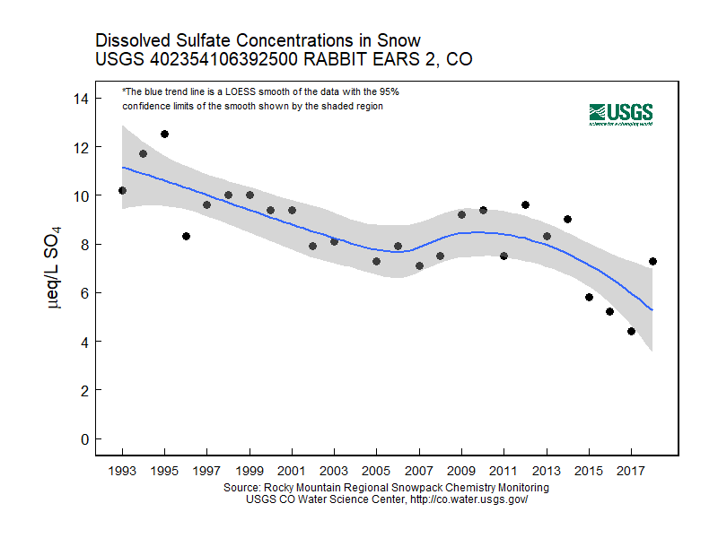
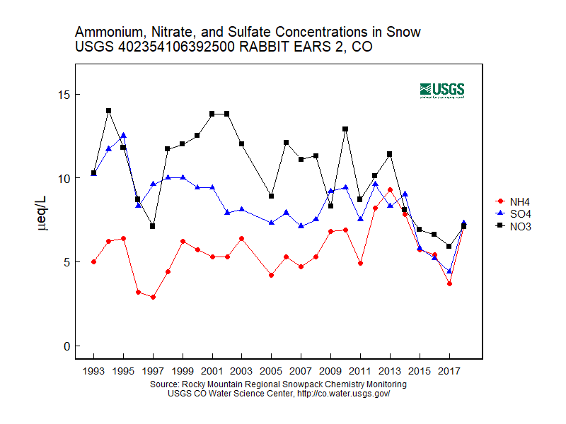
Graphs of Chemistry Concentrations
Graph of Snow Depth
Data
- Table of data (download csv)
Photographs
 Forest clearing with collocated snowpits at Rabbit Ears 1 & 2, Colo. |
 Snowmobile access to Rabbit Ears 1 & 2, Colo. |
 Snowmobile access to Rabbit Ears 1 & 2, Colo. |
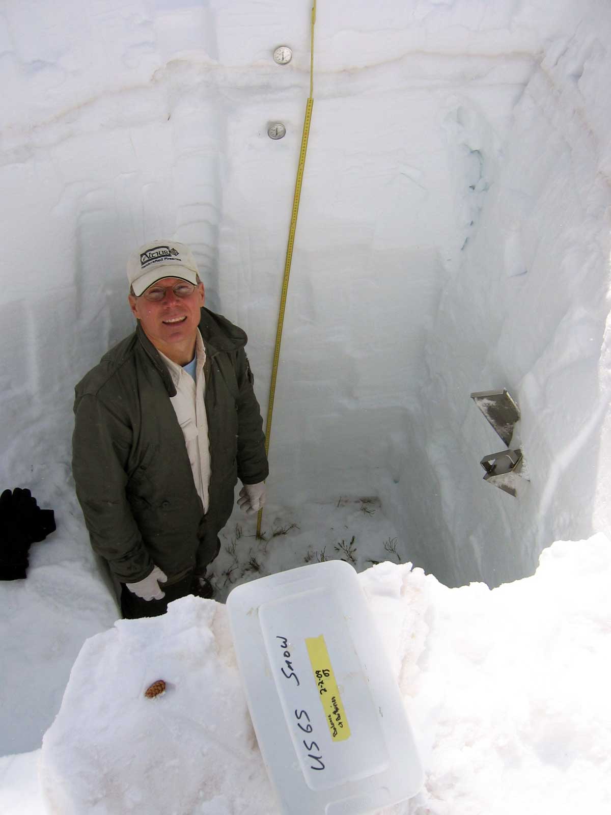 Snowpack-sampling pit at Rabbit Ears 1 & 2, Colo. |