Rocky Mountain Regional Snowpack Chemistry Monitoring Study
Project Navigation
Questions?
Contact: Graham Sexstone
Ripple Creek NADP, Colo.
- Station ID: 400510107184301
- Latitude: 40.08610 dd
- Longitude: -107.31194 dd
- Elevation: 2938 m
- 15 years of data
2003 - 2020 ( no data, 2008, 2015, 2019 )
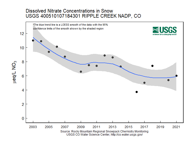
Graphs of Chemistry Concentrations
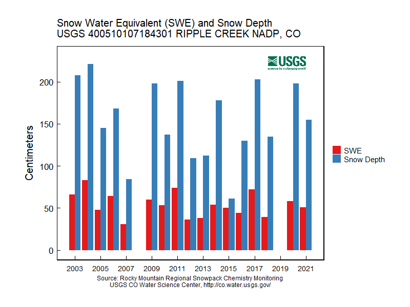
Graph of Snow Depth
Data
- Table of data (download csv)