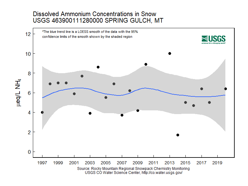
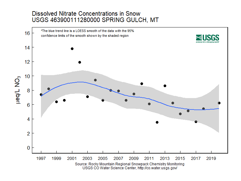
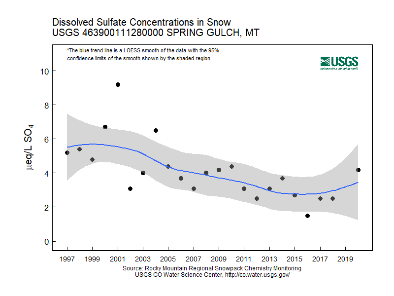
Rocky Mountain Regional Snowpack Chemistry Monitoring Study
Project Navigation
Questions?
Contact: Graham Sexstone
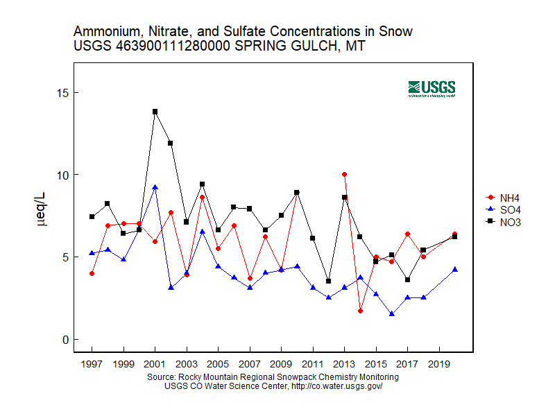
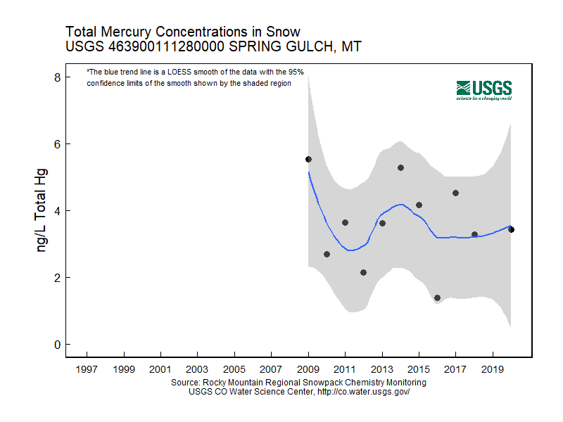
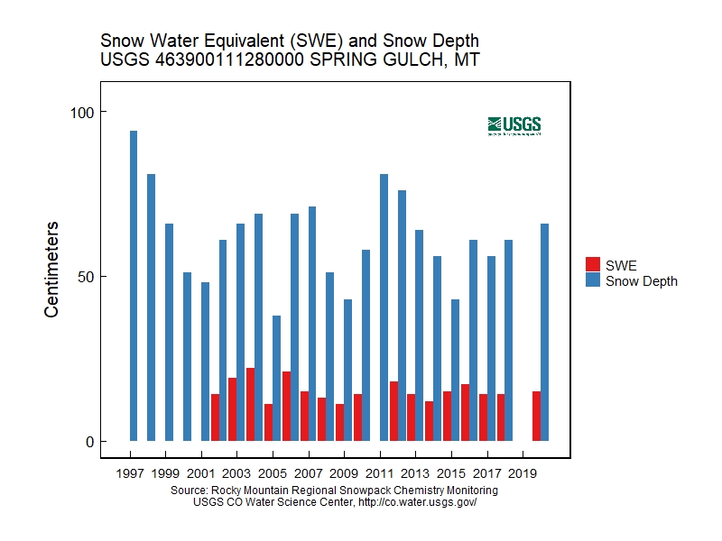
Spring Gulch, Mont.
- Station ID: 463900111280000
- Latitude: 46.65000 dd
- Longitude: -111.46667 dd
- Elevation: 1826 m
- 23 years of data
1997 - 2020 ( no data, 2019 )
Graphs of Chemistry Concentrations
Graph of Snow Depth
Data
- Table of data (download csv)