Rocky Mountain Regional Snowpack Chemistry Monitoring Study
Project Navigation
Questions?
Contact: Graham Sexstone
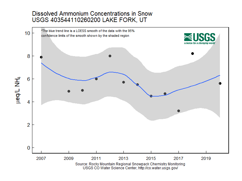
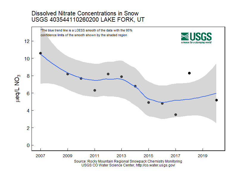
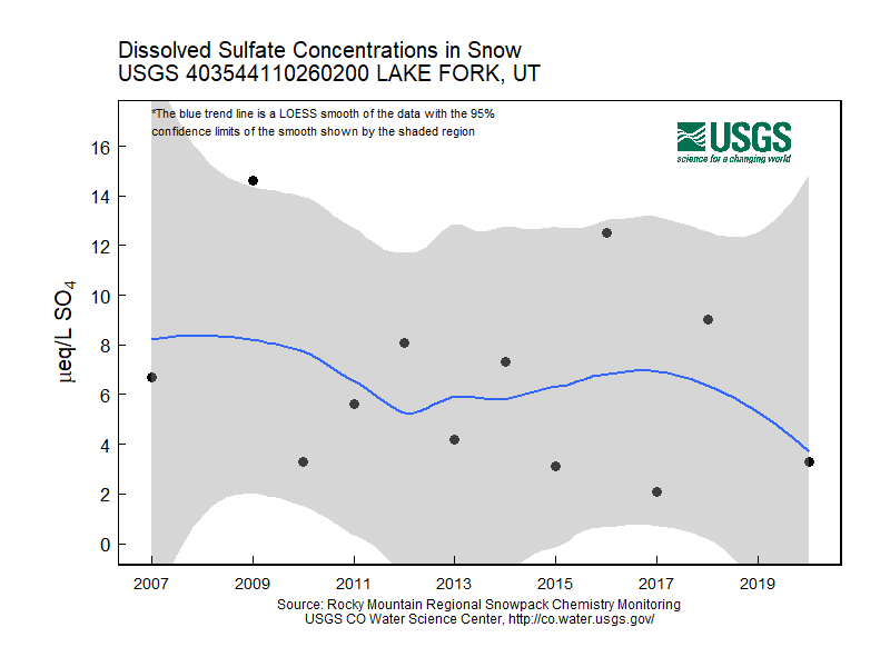
Lake Fork, Utah
- Station ID: 403544110260200
- Latitude: 40.59556 dd
- Longitude: -110.43389 dd
- Elevation: 3093.72 m
- 12 years of data
2007 - 2020 ( no data, 2008, 2019 )
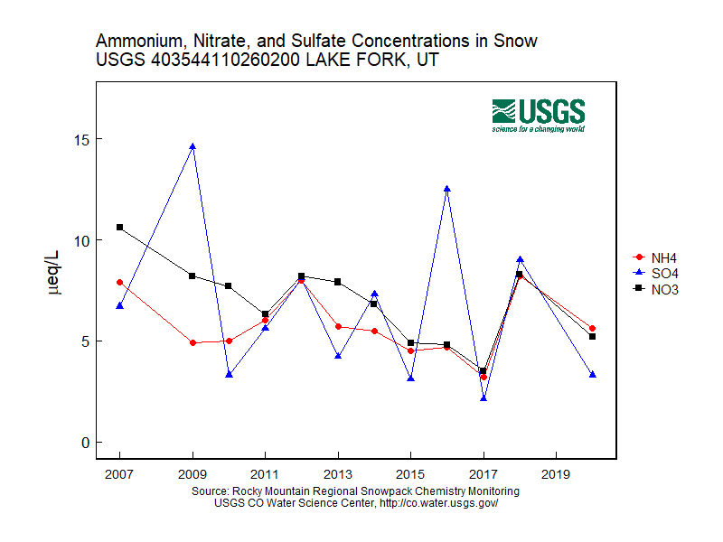
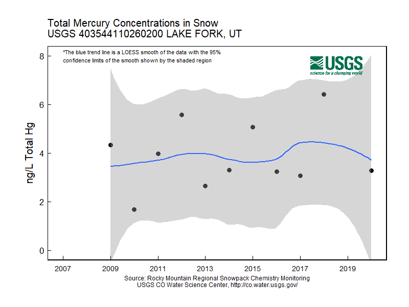
Graphs of Chemistry Concentrations
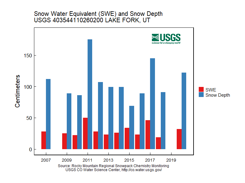
Graph of Snow Depth
Data
- Table of data (download csv)