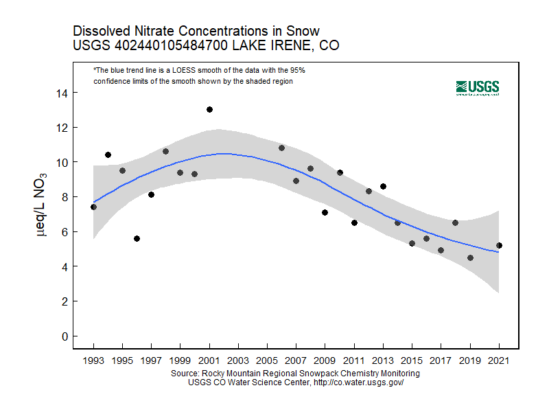
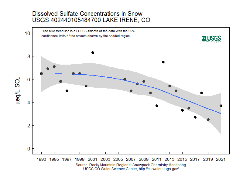
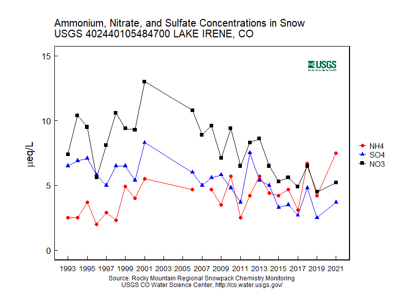
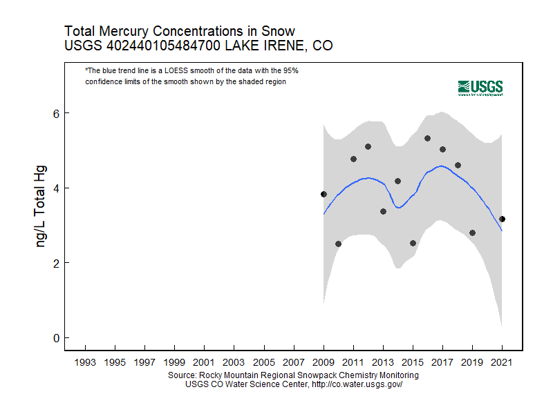
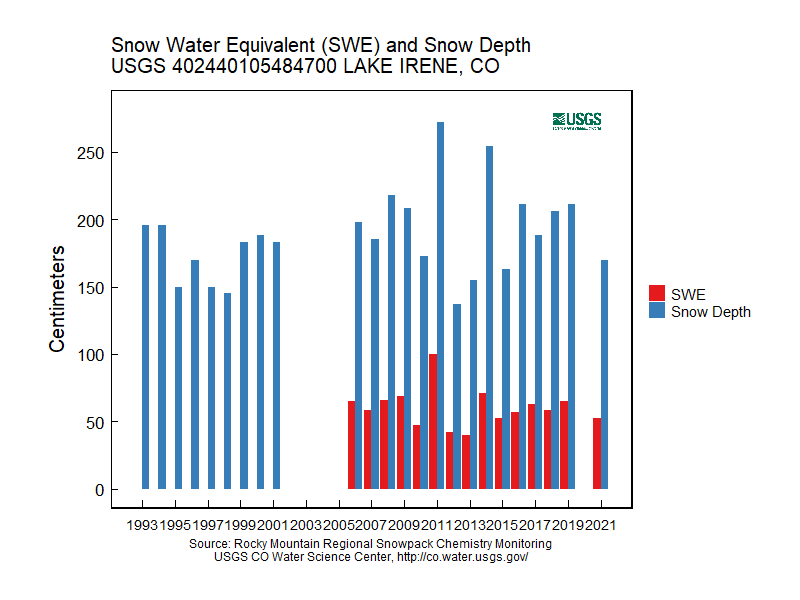
Rocky Mountain Regional Snowpack Chemistry Monitoring Study
Project Navigation
Questions?
Contact: Graham Sexstone
Lake Irene, Colo.
- Station ID: 402440105484700
- Latitude: 40.41508 dd
- Longitude: -105.81925 dd
- Elevation: 3256 m
- 23 years of data
1993 - 2020 ( no data, 2002, 2003, 2004, 2005, 2020 )
Graphs of Chemistry Concentrations
Graph of Snow Depth
Data
- Table of data (download csv)
Photographs
 Workers prepare to haul snow samples away from site at Lake Irene, Colo. |
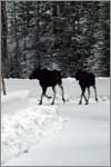
 Moose on road to Lake Irene, Colo. |